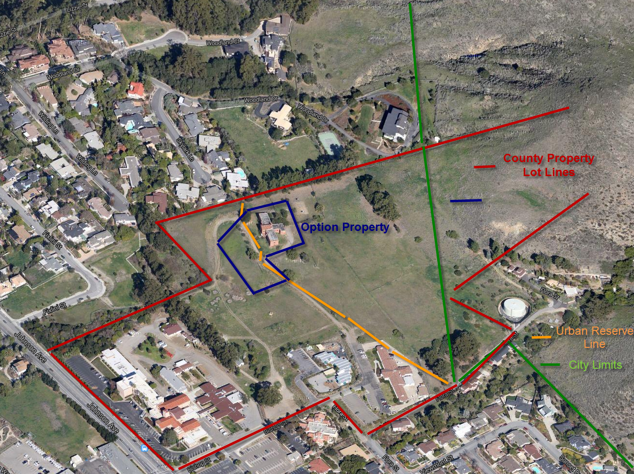
Property Map
This map shows the satellite view of the existing area with the various property lines, option lines, city boundary and Urban Reserve Line (the city’s upper limit for new buildings) approximately drawn in. These lines were obtained from the County Lot maps, the Options agreement and the LUCE update draft document.